|
|
|
|

|
Ferry van Eeuwen
|

|
Weather Satellites
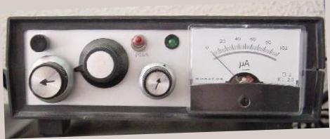
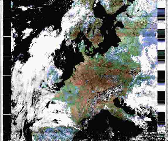
My homebuilt weather satellite receiver. As part of the radio hobby I receive weather pictures from a number of weather satellites who pass overhead in a earth orbit at different and every day changing times. The number of satellites which can be received is rather small. I receive pictures from the American NOAA-satellites (12 and 14) and the Russian Resurs-satellite. The equipment I use consists out of home built receiver connected to a so called Quadrifilar antenna with inside a pre-amplifier (both home made). The received audio output is fed into the computer's soundcard which have a very sophisticated analog to digital converter on board. The digitalized data is processed by a program WxSat. I use version 2.4 although version 2.59 is also available. The quality of the decoded weather pictures are most of the time quite good. An example of such weather picture is shown here:
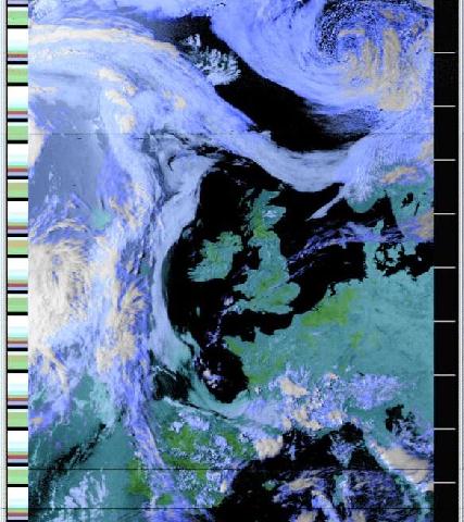
This is a picture as received by me of the NOAA-12 weather satellite on May 23, 2001. The horizontal white markers on the black band to the right are minute markers. In less than 10 minutes the satellite sweeps a broad path over western Europe as shown. After about 90 minutes the satellite is popping up over the horizon again, but than in an orbit more to the left. In this manner the earth's surface is 'peeled'. The weather in Holland as you can see was excellent that day. Southern Italy is covered with dense clouds spelling out a lot of thunderstorms going on. You can see a artificial picture of the earth as seen now by the NOAA-12 weather satellite (height 802 km) at the following URL: http://www.fourmilab.ch/cgi-bin/uncgi/Earth To see the views of other satellites, not necessarily weather satellites, your can make a choice out of many at URL: http://www.fourmilab.ch/earthview/satellite.html I use a satellite tracking program to predict the time that the satellite will be in reach. The name of this program is SatScape and the Version is 1.84
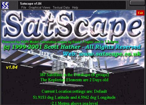
Satscape is a freeware program you can download it from the internet. The latest versions is v1.86 Build 3. To download this very good program go to URL: http://members.tripod.com/satscape/ When connected to the internet and with the program running you can easily update the Keplerian elements to have the most accurate orbits of the satellites which can be chosen from a list. These satellites are then presented on a map. You can make your choice again from a number of maps to suit your location best. Click the 'SatScape Control Panel' to the upper right, then click on 'Groups and Keplerian Elements' and in conclusion click on 'Keplerian Element Update and Clock Sync'. The program will then started downloading the latest Keplerian Elements.
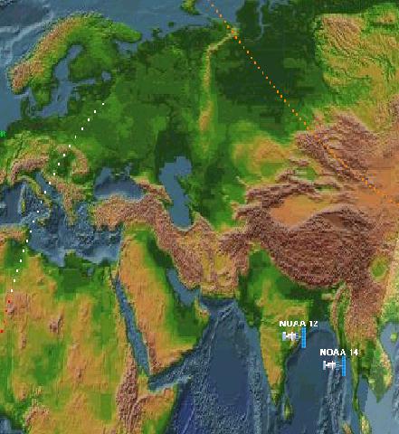
This is an example of a map as produced by Satscape. The NOAA 12 en 14 can be seen 'twinning' almost. Both are flying over India and the Indian Ocean. The date is February 7, 2002 and the time is 00:36 local time. The direction and 'footprint' can normally be seen also, but not in this picture.
A picture from the recently orbited NOAA-17 received on July 29, 2002 at 1223 local time. The red colours indicate high temperature zones. Also Holland is for a change in the hot zone. Temperature at 1538 local time is 35.5° Celsius here in Krimpen a/d Yssel. |